


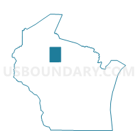
FIFIELD - T 2 Voting District, Price County, Wisconsin
About
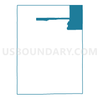
Outline

Summary
| Unique Area Identifier | 696321 |
| Name | FIFIELD - T 2 Voting District |
| County | Price County |
| State | Wisconsin |
| Area (square miles) | 83.82 |
| Land Area (square miles) | 78.83 |
| Water Area (square miles) | 4.98 |
| % of Land Area | 94.06 |
| % of Water Area | 5.94 |
| Latitude of the Internal Point | 45.89335040 |
| Longtitude of the Internal Point | -90.15163550 |
Maps

Graphs
Select a template below for downloading or customizing gragh for FIFIELD - T 2 Voting District, Price County, Wisconsin


Neighbors
Neighoring Voting District (by Name) Neighboring Voting District on the Map
- EISENSTEIN - T 2 Voting District, Price County, WI
- EMERY - T 1 Voting District, Price County, WI
- FIFIELD - T 1 Voting District, Price County, WI
- LAC DU FLAMBEAU - T 2 Voting District, Vilas County, WI
- LAKE - T 1 Voting District, Price County, WI
- MINOCQUA - T 5 Voting District, Oneida County, WI
- SHERMAN - T 1 Voting District, Iron County, WI
- WORCESTER - T 4 Voting District, Price County, WI
Top 10 Neighboring County Subdivision (by Population) Neighboring County Subdivision on the Map
- Minocqua town, Oneida County, WI (4,385)
- Lac du Flambeau town, Vilas County, WI (3,441)
- Worcester town, Price County, WI (1,555)
- Lake town, Price County, WI (1,128)
- Fifield town, Price County, WI (901)
- Eisenstein town, Price County, WI (630)
- Emery town, Price County, WI (297)
- Sherman town, Iron County, WI (290)
Top 10 Neighboring Elementary School District (by Population) Neighboring Elementary School District on the Map
Top 10 Neighboring Secondary School District (by Population) Neighboring Secondary School District on the Map
Top 10 Neighboring Unified School District (by Population) Neighboring Unified School District on the Map
Top 10 Neighboring State Legislative District Lower Chamber (by Population) Neighboring State Legislative District Lower Chamber on the Map
- Assembly District 34, WI (53,812)
- Assembly District 87, WI (52,707)
- Assembly District 74, WI (52,623)
Top 10 Neighboring State Legislative District Upper Chamber (by Population) Neighboring State Legislative District Upper Chamber on the Map
- State Senate District 29, WI (167,310)
- State Senate District 25, WI (162,546)
- State Senate District 12, WI (157,332)
Top 10 Neighboring 111th Congressional District (by Population) Neighboring 111th Congressional District on the Map
Top 10 Neighboring Census Tract (by Population) Neighboring Census Tract on the Map
- Census Tract 9400, Vilas County, WI (3,473)
- Census Tract 9701, Price County, WI (2,664)
- Census Tract 9710.02, Oneida County, WI (2,337)
- Census Tract 1803, Iron County, WI (1,909)